Bracken Systems

Application

Preflight

Live

Describe the mission and Preflight returns a brief for informed decision making: weather and winds aloft, illumination, terrain masking, and the link margin every radio actually has over real elevation data. It marks where a link falls below the margin it needs before anyone drives to the field, and exports files the end user devices already read.

Access is by arrangement. Signing in asks for your email and sends a one-time code; if no code arrives within a minute, you are not on the list yet. Email info@brackensystems.com and say what you fly.

The whole loop in a minute

Plan the sortie here, fly it, and feed the flight back through Postflight, which calibrates the aircraft the next plan is made with.

Silent, captioned. A made-up mission over the Boulder foothills and a simulated flight, so nothing in it is a client's data or a real operation.

What it returns

One call per finding, and the figure behind each call, so a decision is made on the reason rather than on the verdict.
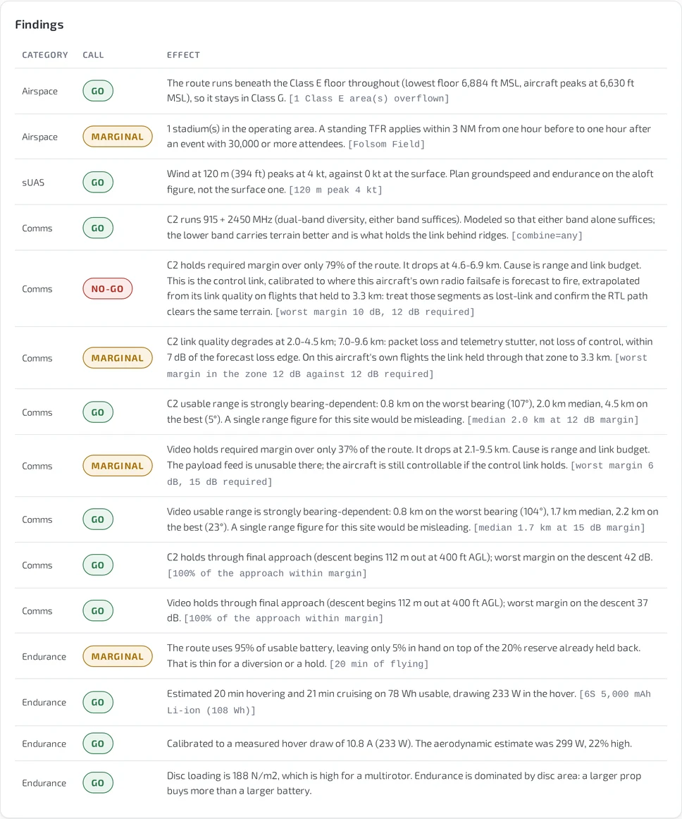
Findings table: each finding carries a category, a go, marginal or no-go call, and the effect in plain language with the figure it came from.
The findings table is the output that matters. Airspace, weather aloft, each link, endurance: every line carries a call, the effect in plain language, and the number behind it.
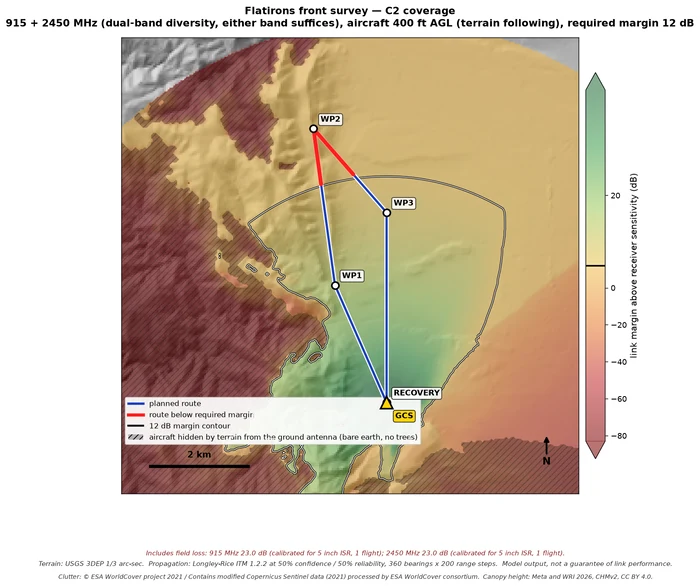
Link margin coverage map over hillshaded terrain, with the planned route, the required-margin contour and the segments below it in red.
Link margin for one radio across the whole area, with the required-margin contour drawn in and everything hidden from the ground antenna by terrain hatched.
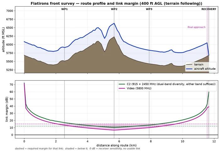
Route profile showing terrain against planned aircraft altitude, with link margin for the control and video links plotted underneath.
Terrain against planned altitude along the route, with the margin on every link plotted underneath and the required threshold drawn in.

In the field

Every run writes a georeferenced overlay file, so the plan opens in the tools already on the bench and in the operator's hand.
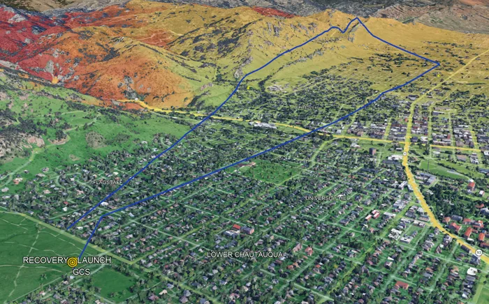
Planned route drawn over three dimensional terrain, with launch, waypoint and recovery markers and the coverage overlay draped on the hills.
The plan in three dimensions, coverage draped on the terrain, before it is flown for real.
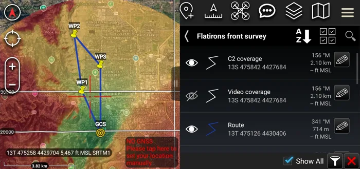
The same plan loaded on a handheld end user device, with the coverage overlay for the command link switched on.
The same file on the end user device, so the coverage the planner saw is the coverage in the operator's hand.

How a mission goes in

A form, not a project file: a route on the map or an imported KMZ, the window, the radios you actually fly, and a saved aircraft that carries its own calibrated figures.
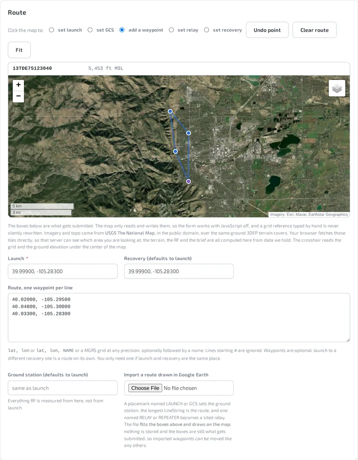
The mission form's route section: a satellite map with launch, waypoints and recovery, and the coordinates written into the boxes beneath it.
The map reads and writes the boxes underneath it, so the form works with a grid reference typed by hand and never silently rewrites one.